1
Photography
5825 readers
146 users here now
A community to post about photography:
We allow a wide range of topics here including; your own images, technical questions, gear talk, photography blogs etc. Please be respectful and don't spam.
founded 2 years ago
MODERATORS

3
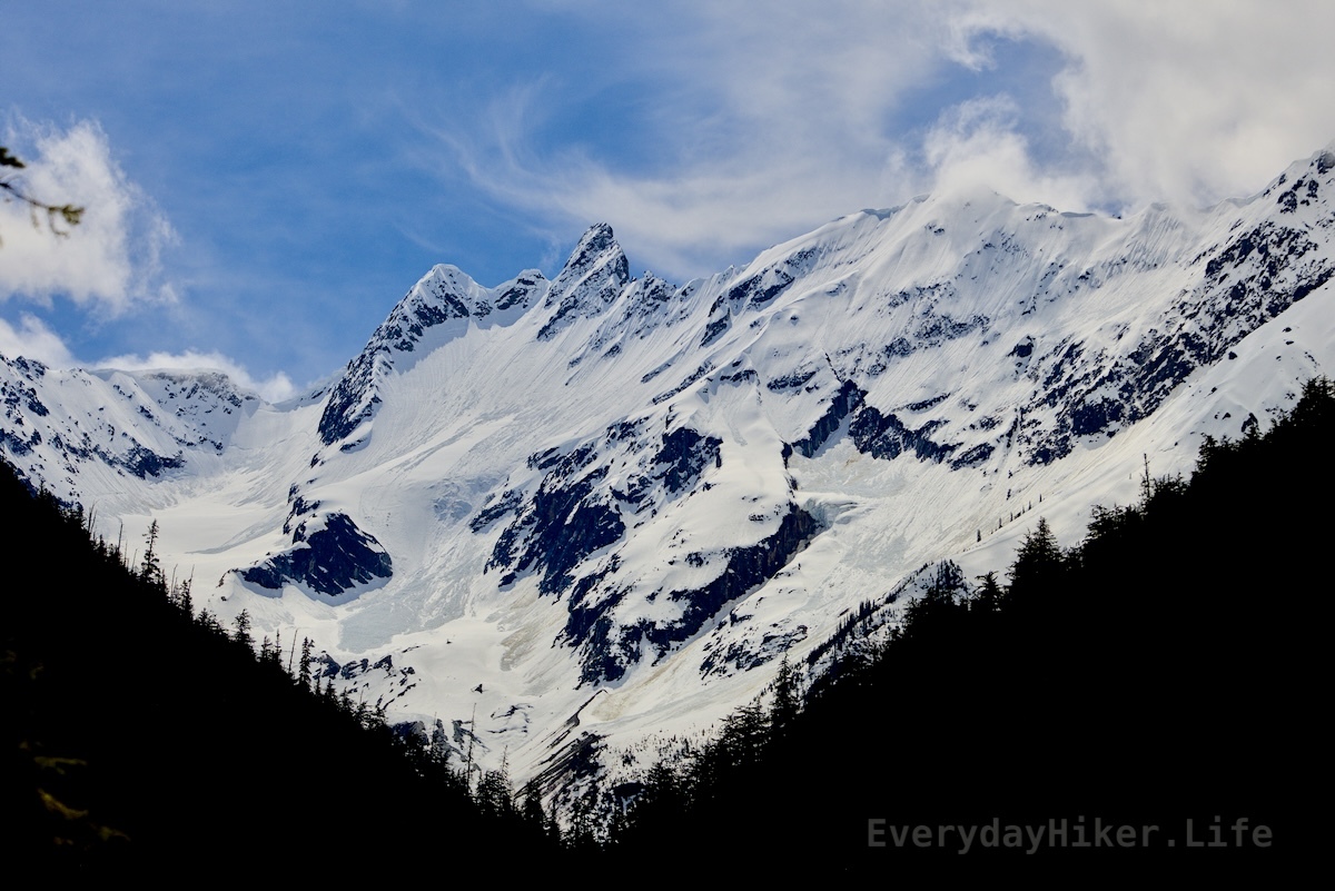
Moderate 10.7 mi Out and Back 2,500ft elevation gain Extends from Emerald Lake Trail Hiked 6/5/25
This fantastic hike leaves Emerald lake and climbs into a large bowl in between Wapta Mtn and the Oresident range. Bowl area is full sun while keeping a fairly steep pace on the way into Yoho Pass. Deep snow at time of hike for over 1 mile on pass, melty on way back with post-holing. Very Popular. Same trail I saw the Ruffed Grouse on that I posted a while ago, reposted in here as well.

Wapta mountain sits across from the serene waters of Yoho lake. Still a little avalanche to be let go of on the mountain, and that side of the lake was still deep snow. Red chairs just out of frame.

Looking up towards Angle Peak with a large field of snow still at the top of the Avalanche zone beyond it.

The view as you decend from Yoho pass back into the valley shows the many tracks the stream flows take in the large avalanche zone feeding into Emerald Lake. Mt Deville lies behind the Tocher ridge in the distance.

A ruffed grouse was on the trail as I turned a corner, trusting in it's camoflage until the right moment to make a break.
Short video if the seasonal fall on Bluesky
4
It started as a test image, but I rather like how it turned out

5
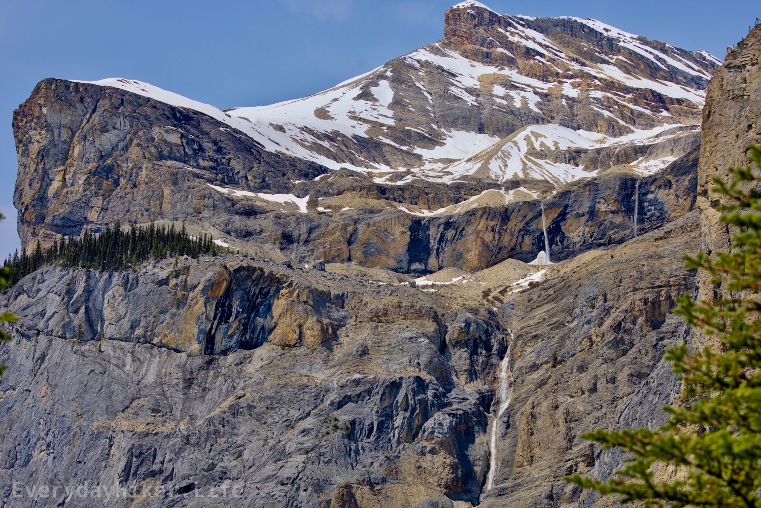
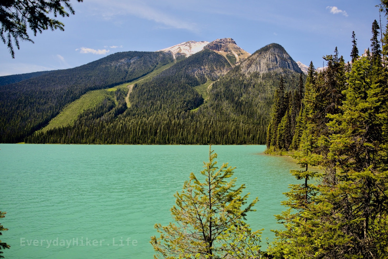
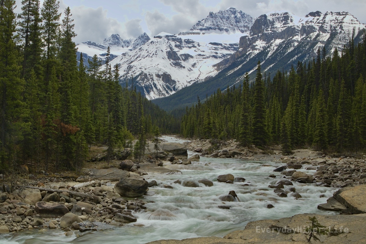
Nature walk, 3.2 mi loop 406 ft Hiked 6/5/25
An extremely popular lake in Yoho National Park, this nature walk can be done as a full loop or shortened to near nothing and still be enjoyable. Named for its vibrant color, Emerald lake is surrounded on all sides by stunning views of the local mountains, and serves as an access to several great larger hikes such as Yoho Pass/Yoho Lake.

Looking south across Emerald lake towards Mount Burgess which is reflected in the rippled water.
The view from the south side of Emerald lake showing the avalanche zone of Emerald peak, which was still closed due to avalanche risk at the time.

Looking north from Emerald lake shows the vast avalanche field and flood plains that feeds the lake. Carmar peak, Mt Marpole, and the ridge leading up to the President sit in the background.

6
43
PNG has been updated for the first time in 22 years — new spec supports HDR and animation
(www.tomshardware.com)

8
Moderate 8.6 mi out and back 2,192 ft elevation gain Hiked 6/4/25
An easy hike to a beautiful lake combined with a steep hike to the fabulous views from Paget Lookout. The trail splits at about halfway to each so could be isolated. Lookout trail is steep but well maintained and a scramble to Paget Peak could be added, ranger said it was a week or two from being ready, but I did see one group continue on at the time. Amazing views of Cathedral mountain as well as Divide mountain and Mt Whyte and the surrounding area.

A Trail view cutting across the steep slope of Paget mountain that shows the Cathedral mountains to the right. This is the only level section of the Lookout section and it is short lived.

The rear side of the lake has one section that passes through a washout. Trail may be seen wrapping around the beautiful lakeside with Cathedral mountain off in the distance.

Looking across the stunning waters of Sherbrooke lake towards the avalanche zone of Mt Ogden, currently a waterslide.

9
Camped near Reynolds Pond and was treated to a glorious sunset last night.

10
Moderate 3.8 mi out and back 1,332 ft elevation gain Hiked 6/3/25
Beginning at the former Yoho NP campground, this short but steep trail takes you to one of the many great hoodoos found along the Canadian Rockies. As the trail crosses multiple washout areas, the trail degrades in places but remains manageable. A split towards the end takes you to different views which are both pretty cool, but both washed out a lot/steep.

The view up at the hoodoos from the lower trail terminus. Trees grow in the more stable sections of the hill.

An upstream view of Hoodoo creek taken from the walking bridge. Mountains may be seen in the distance.

This section of the lower hoodoos trail was very degraded, with atleast one foothold wedged into the slide.

11
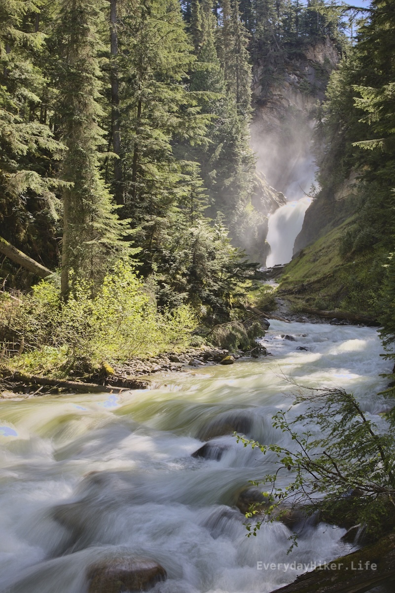
Easy to moderate 7 mi out and back or short walk to falls only 1,496 ft elevation gain Hiked 6/1/25
Located in the Thompson Falls recreation area not too far from Golden BC this is a great waterfall with an ok trail that could be shortened to maybe half a mile or so of a mild slope. Falls were way overfull at time of hike, but appear to be a worthwhile stop, perhaps while camping in the area.

Another view of Thompson falls from a little further away, which better shows the shelf under the rushing river.

The uppermost section of falls along the trail, looks like it would have been a small cascade on the far side with a rapid on the near. Currently very blown out, the downed trees on the farside are stuck.

A jumble of fallen trees suspended in the forest. (Marge voice: I just think they're neat!)
Bluesky link to post with Videos of the falls

12
Somehow I had been stuck on Darktable 3.8 for a while, so I finally uninstalled the system package of it, and bumped up to the 5.2 flatpak, and it's amazing! A bit of adjustment, and there we go! King says hi. I hope eventually rhinos can multiply and be less critically endangered.
Thanks for seeing my work!

13
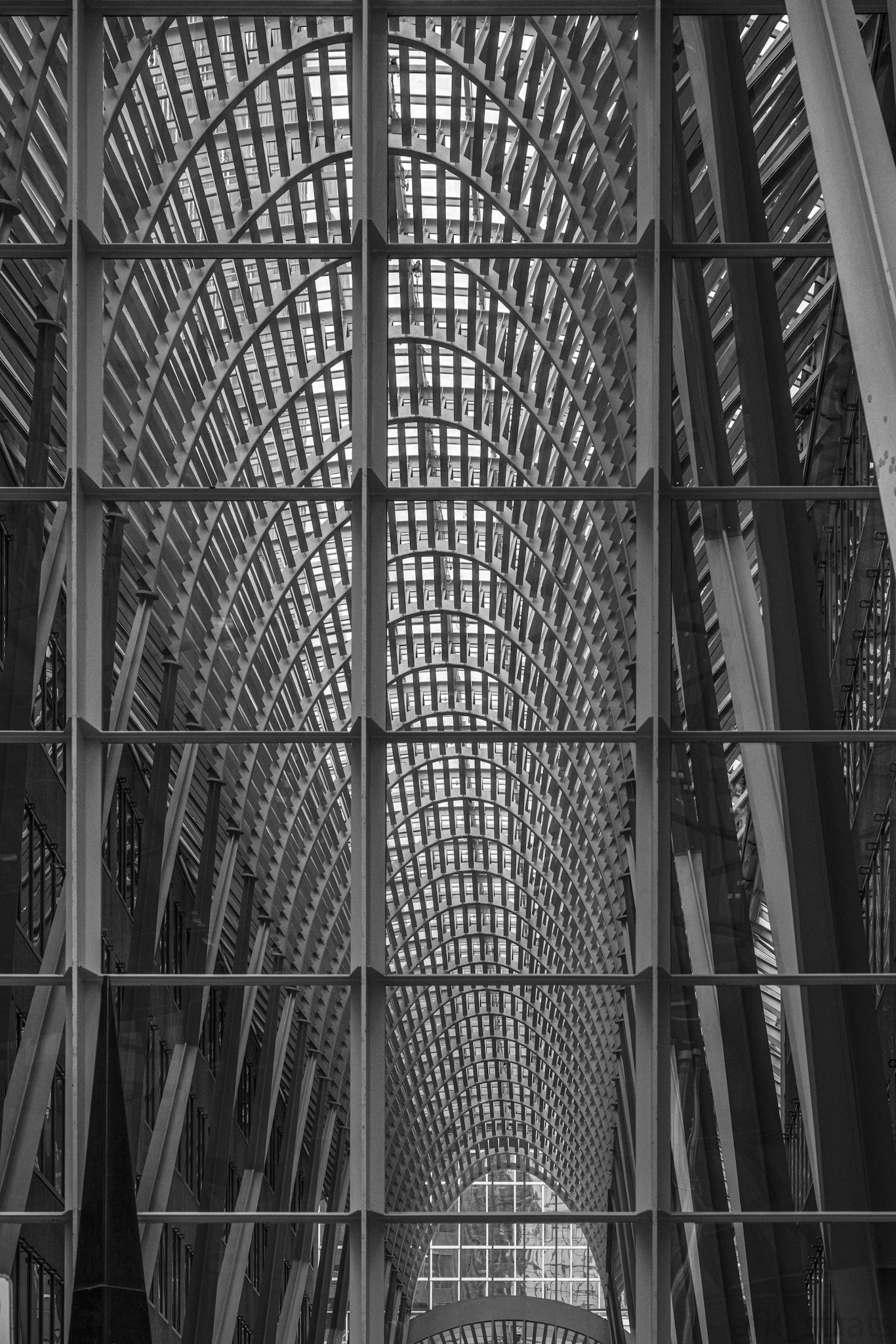
Somewhere in Toronto. I just stumbled across this and thought it would be a cool shot.
14
I’ve been seeing these signs pop up everywhere, sometimes in the most unexpected places.
They help.
Thanks for seeing my work!

15
Easy, 2.9 mi out and back 407 ft elevation gain Hiked 6/2/25
A massive waterfall awaits you at the end of this short hike with minimal effort to access. You’ll reach the falls at the upper stage and there is a short but steep drop from there with a middle viewpoint as well as a large creekside vantage from downstream a bit.

Wapta falls from the middle viewpoint shot at 1/3s. Chancellor peak/Aquila mountain in the distance.

Wapta Falls from the middle viewpoint shot at 1/320s.

The upper view of Wapta falls, showing that weird mound that’s built up just downstream.
Link to Bluesky post with short video

16
Easy, short but steep 1 mile out and back 312 ft elevation Gain Hiked 5/27/25
This short trail begins with a very steep grade down to Connaught creek (formerly bear creek) with a stair section at the lowest. Photos of the falls come from this area downstream. Climbing another staircase puts you at the falls, surrounded by a massive mist cloud. Entertaining, but no pics. This was still during melt season and it was absolutely raging at the time.
Connaught creek rushes by as Bear creek falls rages in the distance.

The steep stairwell leading to the river below.

The steepest part of the trail is these steps, but it maintains a lot of slope in its short run.

17
I wanted to capture the most glaring bits of modern suburbia, of modern infrastructure, in a crunchy and appealing frame and contrast. I was also hassled by a cop while I took this.
Thanks for seeing my work!


19
Location: Lake Ontario, Mississauga
Date: 30 May 2025, 5:44pm
Camera: Sony A6700 with Sigma 18-50 f/2.8 DC DN

20
Easy 3.2 mi out and back/loop or easier 0.8 mi hike starting at Illecillewaet campground 436 ft elevation gain Hiked 5/27/25
This route adds on the early flat section of the Great Glacier trail to get to the historical Glacier House remains before a beautiful joining of water along the Illecillewaet river as various water flows combine. Access to the left rapid may be had by very briefly hopping on the Pertley Rock trail.

The bridge spanning Illecillewaet river after Asulkan brook joins it.

Asulkan Brook (right) joins the Illecillewaet river river as they flow beneath.

Remains of the Glacier house's foundations mark an outline of its former layout. Information may be found along the trail.


22
23
Length: 0.5 mi loop Elevation gain: 115 ft Hike date: 5/27/25
This quick nature walk would serve as a great spot to have a picnic or to quickly stretch your legs. It still manages to provide a few different view types, including a great view of Bonney glacier to the south as well as a small boulder field and a lush forest that is taking over the rocks.

The trail through the boulders has been laid out using rocks from the boulder field making an easy path.

Pine forest and moss slowly overtakes the rock field.
24
Easy 1.5 mile Loop 300 ft elevation gain Hiked May 23, 2025
An extremely popular hike due to its ease and location north of Lake Louise on the Icefields Parkway, this hike puts you right on top of the falls where you may wander along the top of the canyon and see the various water chutes. A short loop uses part of the Mt Sarbach trail to get a higher view. Both parking and the people can be a mess here, so plan accordingly.

Where the river meets the canyon creating a short but turbocharged waterfall.

Mistaya canyon unfolds towards Mount Sarbach in the distance.
Mount Sarbach in the distance with Mistaya river and a forest extending downstream.

25
view more: next ›