
1
OpenStreetMap community
4435 readers
22 users here now
Everything #OpenStreetMap related is welcome: software releases, showing of your work, questions about how to tag something, as long as it has to do with OpenStreetMap or OpenStreetMap-related software.
OpenStreetMap is a map of the world, created by people like you and free to use under an open license.
Join OpenStreetMap and start mapping: https://www.openstreetmap.org/.
There are many communication channels about OSM, many organized around a certain country or region. Discover them on https://openstreetmap.community/
https://mapcomplete.org/ is an easy-to-use website to view, edit and add points (such as shops, restaurants and others)
https://learnosm.org/en/ has a lot of information for beginners too.
founded 5 years ago
MODERATORS
2
4
5
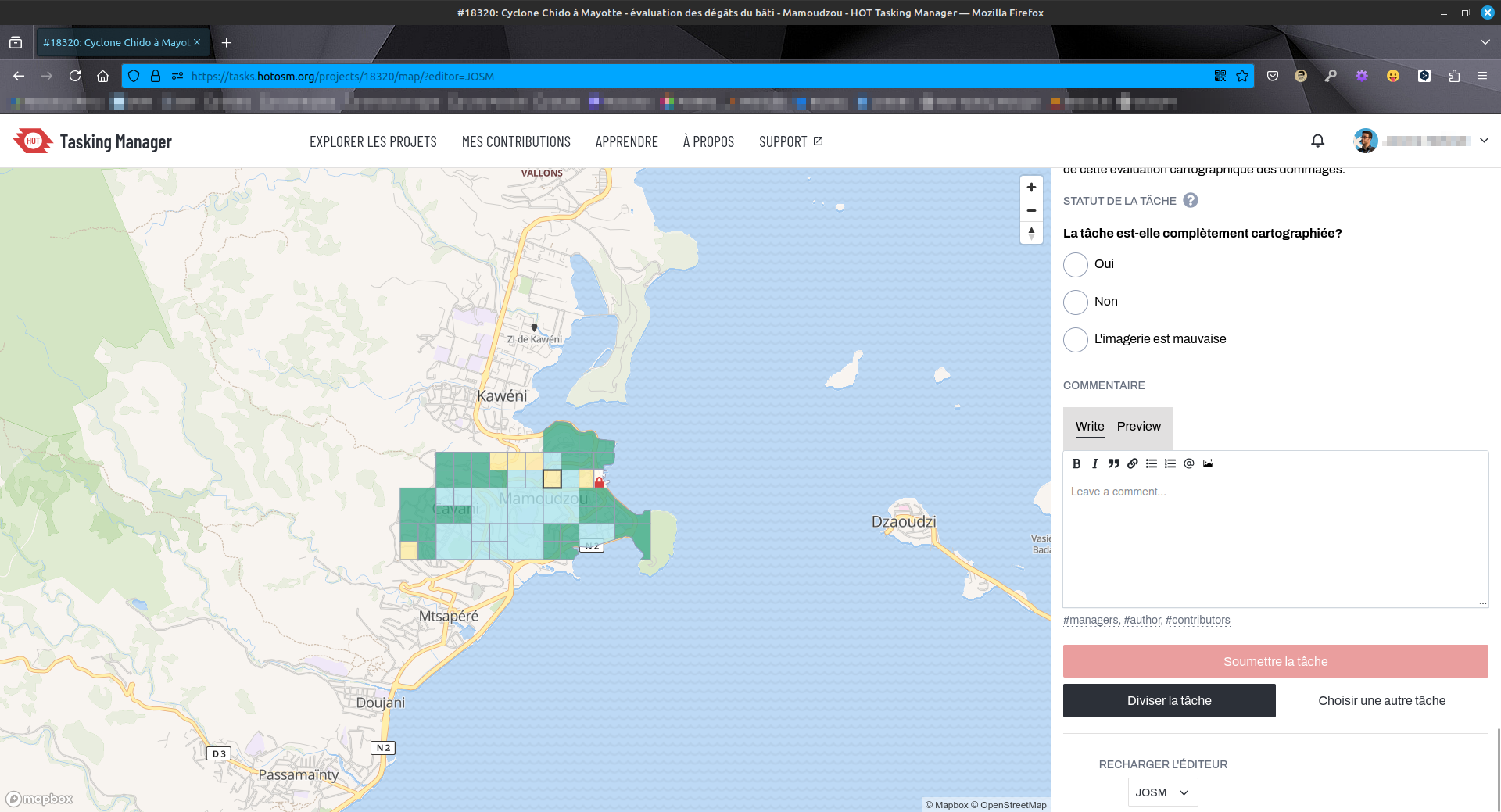
🌀 :openstreetmaps: Travaux d'évaluation des dégâts sur #Mayotte sur #OpenStreetMap via #HOTOSM. État de destruction de chaque bâtiment évalué (🟢 aucun, 🟡 minimal, 🟠 important, 🔴 complet). Outil :
(mastodon.zaclys.com)
🌀 :openstreetmaps: Travaux d'évaluation des dégâts sur #Mayotte sur #OpenStreetMap via #HOTOSM. État de destruction de chaque bâtiment évalué (🟢 aucun, 🟡 minimal, 🟠 important, 🔴 complet). Outil : #JOSM. Photos post-cyclone fournies pas le #CNES #Airbus.
🔗 URL projet : https://tasks.hotosm.org/projects/18320/tasks/
👋 @openstreetmap@en.osm.town @osm_fr @openstreetmap@lemmy.ml
#️⃣ #humanitarian #humanitaire #OSM #climate #climat #solidarité #logicielslibres #opensource #freesoftware #FOSS #FLOSS #cartographie #cartography #hurricane #HOTOSM
5
6
7
8
9
10
11
12
13
14
15
Hi, not sure about the english word. How do I map such a passage for water under a road?

16
17
18
19
50
The OSM Community discusses the Trump Administration's renaming of "The Gulf of Mexico" to "The Gulf of America"
(community.openstreetmap.org)
20
21
22
16
Rapid editor v2.5 released with advanced pedestrian mapping and more!
(community.openstreetmap.org)
23
24
7
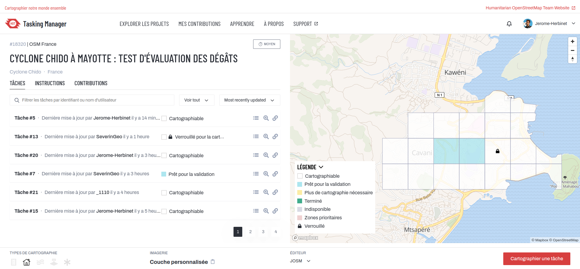
🌀 :openstreetmaps: La cartographie de #Mayotte après le passage du #cyclone #Chido se profile à l'horizon (phase de test) sur #OpenStreetMap via #HOTOSM. Travail obligatoirement via #JOSM. Photos
(mastodon.zaclys.com)
🌀 :openstreetmaps: La cartographie de #Mayotte après le passage du #cyclone #Chido se profile à l'horizon (phase de test) sur #OpenStreetMap via #HOTOSM. Travail obligatoirement via #JOSM. Photos satellites post-cyclone fournies pas le #CNES / #Airbus.
🔗 URL projet : https://tasks.hotosm.org/projects/18320/tasks/
👋 @openstreetmap@en.osm.town @osm_fr @openstreetmap@lemmy.ml
#️⃣ #humanitarian #humanitaire #OSM #climate #climat #solidarité #logicielslibres #opensource #freesoftware #FOSS #FLOSS #cartographie #cartography #hurricane #HOTOSM
25
view more: next ›